Mount McGuire, in my opinion, is the most beautiful hike in Chilliwack with fantastic views of the Canadian & American Border Peaks, Cheam Range, and Tomyhoi. About 10 years ago this was a go to hike on a sunny day with Borden Creek FSR taking you right up to the alpine on the east side of the mountain. With a washed out bridge, however, I've been looking at Google Earth for a different access into this gorgeous area. Saturday was my third attempt for this mountain, but the first one on a sunny day with clear views. We headed up Tamihi Creek FSR and took the centre fork where it splits into 3 ways. Driving down as far as possible, we parked just before a pile of logs blocked further access. We started hiking at 8:30 and headed straight up through forest for about 2 1/2 hours. Staying to the west side of the tarn we continued up the ridge through snow and the occasional rock scramble. Finally, 6 hours later, we got to the top, only to realize it was a false summit. Conquering McGuire's majestic peak seemed impossible as intimidating vertical cliffs separated us from the actual summit. My hiking companions were content to enjoy the views from their vantage point, but summit fever set in, so I started to explore looking for a different route up. Dropping down into the south bowl, I traveled on snow until I spotted an avalanche shute that seemed manageable. Scrambling up was no problem and 20 minutes later I was standing on McGuire. I snapped a few shots and was about to head back when suddenly 2 hikers appeared from the east side of the mountain. My cousin Lori-Ann was petrified to descend the route we just came up, so after consulting with Erik and Brian, we decided it would be much faster and easier to return using their route and they graciously offered us a ride back to our vehicles. 2 hours later, soaking wet after sliding down insanely steep snowy slopes, we were back at the logging roads and getting a ride back to my truck from our new hiking buddies. Another amazing adventure out in the mountains! A special thank-you to Lori-Ann who provided endless entertainment while she tried to master the art of graceful snow travel :) Now for some pics!!!

 |
| Circumhorizontal Arc as pointed out by Dru from CT |
 |
The colours are caused by light passing through wispy, high-altitude cirrus clouds. The sight occurs only when the sun is very high in the sky (more than 58° above the horizon). What's more, the hexagonal ice crystals that make up cirrus clouds must be shaped like thick plates with their faces parallel to the ground.
|
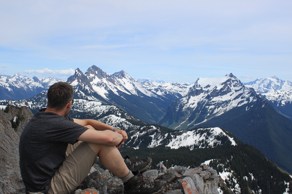
 |
| Views from the west sub summit. |
 |
| Valley view. |
 |
| Cheam Range in the distance. |
 |
| Canadian Border Peak, American Border Peak, Larabee, & Tomyhoi. |
 |
| Summit shot! |


Hi. Wondering if we could get some more info on how you got up McGuire on the other side of the mountain. That is my dad's memorial stone at the top and we haven't been able to get up for a few years because of the washout on the road. If you could email me at tiffanie.mcguire@gmail.com it would be great!!!
ReplyDelete