Tuesday, October 9, 2012

Mount Ruth!

I guess it’s traditional to spend Thanksgiving weekend with the family consuming turkey dinner and pumpkin pie but with summer-like conditions I could not resist hiking for the weekend! On Saturday Ruth and I hiked Hannegan Pass and Copper Ridge and I instantly knew we had to come back and conquer that beautiful mountain resting in the south with a gently rolling glacier that dominated the view. I quizzed the first hikers we encountered and they identified it as Ruth Mountain, a beautiful hike, but requiring equipment such as an ice axe and crampons. Ruth instantly declared, “John, you are not allowed to do that hike without me.” I couldn’t stop staring at the gorgeous glaciers. Fortunately Monday was a holiday so we made plans to come back. I’ve had some exposure to glacier travel in Peru, but the tour guide just handed us an ice axe with no instructions whatsoever on how to utilize it, roped us up, and started trekking! Saturday night I spent some time watching youtube videos on using an ice axe to self-arrest a fall and reading trip reports of Mount Ruth. On Monday Ruth and I met in Sumas at 3:00 in the morning and were hiking by 4:45 in the dark with the stars and moon shining brightly. We had incredible views of the sunrise over the mountains and valleys. Once we reached Hannegan Pass, we took a wrong turn and ending up wasting an hour and a half trying to get back on track. We stumbled upon a group of campers and they pointed us in the right direction. Good thing we had an early start! We hit our first icy patch shortly after and were surprised at how rock solid the snow was. By 11:00 we had reached the furthest expanse of snow free ground, it was time to gear up for the glacier. I couldn’t stop taking pictures, the views were so incredible! At one point I stabbed my ice-axe into the snow to take a few shots when it dislodged and slowly slid down the glacier and out of sight. First my backpack tumbles off a cliff on Larabee, and now this! Oh well, a small price to pay for an incredible experience. By noon we had summited Mount Ruth and were completely blown away with clear skies and panoramic views that stretched for miles. We spent almost an hour at the summit and then another hour searching for my ice axe at the foot of the glacier without success. 12 ½ hours later we were back in the parking lot, ready to rip off our hiking boots and head home. We met one other hiker at the summit who left an awesome topographic map of the North Cascades on my windshield with a note that said, “Hope this helps to ease the pain of losing your ice axe.” Thanks Mike! Kudos to Washington for keeping a well-developed trail system in pristine condition with excellent signage and clean washrooms! Very impressive. B.C. has a long way to go yet! Even though I sacrificed Turkey Dinner, this has been the best Thanksgiving ever! Mount Ruth and Shuksan to the right. First views of Mount Baker Nooksack cirque with Shuksan to the right. Can someone confirm the mountains to the right of 'The Pickets'? Icy Peak with a gorgeous cirque glacier. Gorgeous fall colour!

Monday, September 17, 2012

Mount Larrabee

The weather this September has been amazing and I've definitely been taking advantage of it! There was a late start to the hiking season with a huge mountain snowpack remaining well into July, but it was worth the wait...the views seem to be much more vibrant in late summer/early fall with the absense of smoggy pollution! I haven't really explored much hiking across the border but have had my sights set on Tomyhoi ever since I first summited Mount McGuire. I did Tomyhoi in late August and have since discovered a whole new vast rugged wilderness to explore! You could easily spent an entire lifetime just exploring the Cascade mountain range. From the summit of Tomyhoi I compiled a new bucket list of summits to conquer starting with Mount Larrabee. Larrabee is classified as a class 2 scramble in Matt Gunn's book, but I found this to be more difficult than any other scramble I've done, mostly because the route was unclear. I'm pretty sure the avalance gulley I was ascending on the east side of the mountain would be considered a class 5 scramble and it wasn't until I saw hikers on the west side of the mountain face that I realized I was off track! As I was trying to traverse over to the other side of the mountain, my backpack plummeted off a 500 foot cliff with passports, my SLR camera, and new phone! It took about an hour to locate the backpack resting not so convienently on a very steep glacier. My camera survived, but the phone did not fare so well! It was smashed to bits :( Even though I had to buy a new phone, the hike was worth every bit! For those who don't like scrambling, a well maintained and not so strenuous trail to the 'high pass' is an awesome destination for a day hike! 
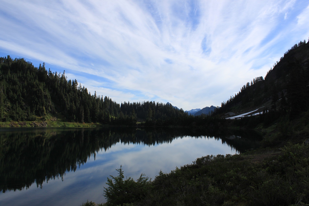
You drive about 12 kilometres on Twin Lakes Road where gorgeous views await at the parking lot! This would be the perfect spot for drive in camping! I'm definitely coming back here again before winter. Wide open views emerge after only 10 minutes of hiking! Beautiful wildflowers in the middle of September!
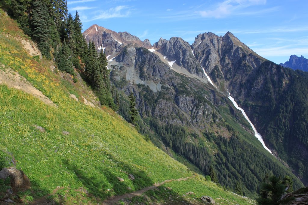
 Mount Larrabee. Mount Tomyhoi in the distance. Wild blueberries in fall spendor. Tomyhoi again with McGuire to the right in the Canadian background.
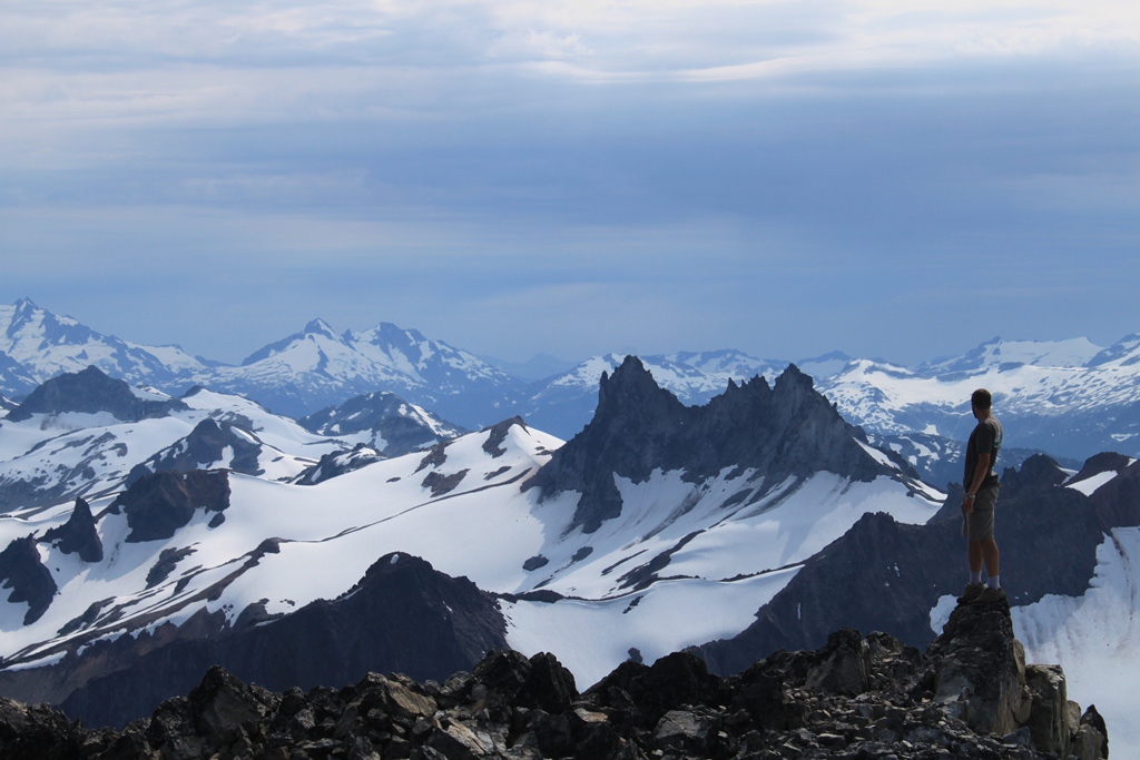
 Route finding... 
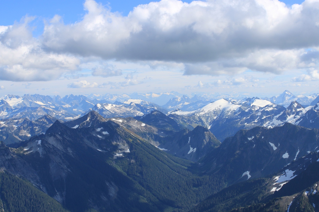
A new wilderness to explore! I love the different levels of mountains in this shot. A very unstable glacier hugging the north side of Larrabee. The Cheam Range in Canada! Starting from the left side you have Cheam, Lady, Knight, Baby Munday, Stewart, Welch, and Foley peaks...all incredible hikes! It's amazing how mountains look totally different from a new perspective. This is the south face of Slesse to the left of the picture. The American Border Peak to the right shadowing the Canadian Border Peak behind it and McGuire to the far left.
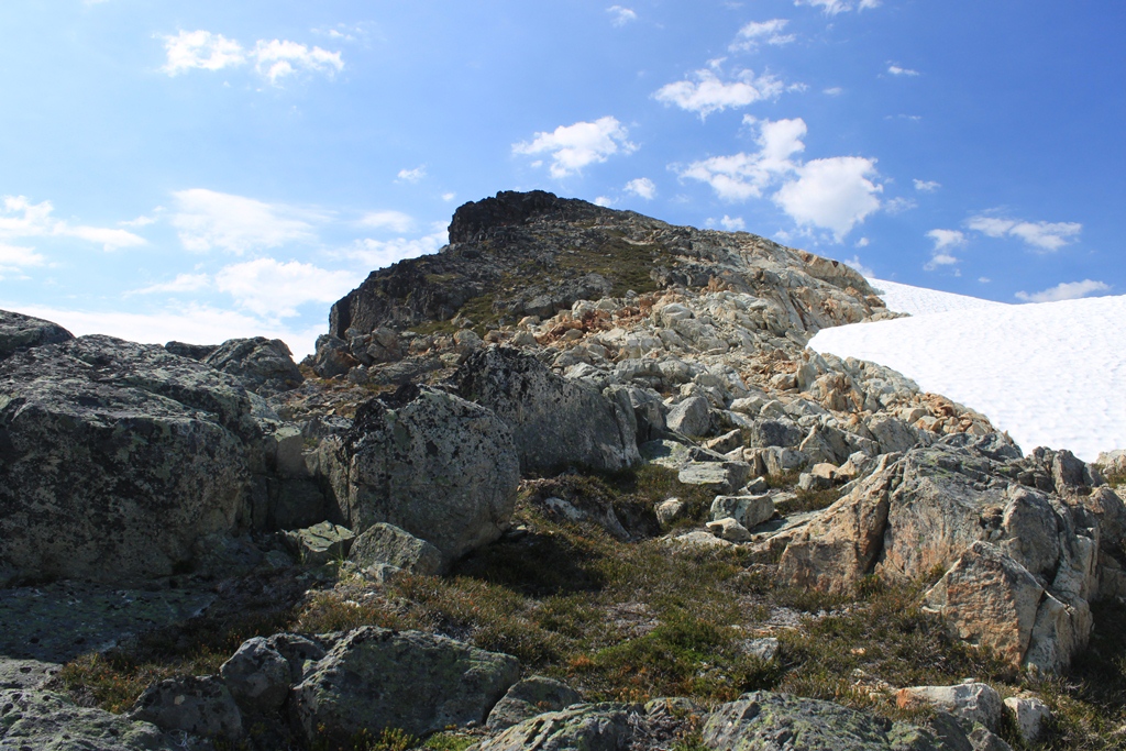
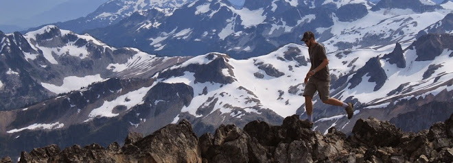
 Summit Shots! Trip reports of Hanging Lakes and Tomyhoi to follow!

Sunday, August 19, 2012

Brandywine Mountain

On Saturday I set out to hike Brandywine Mountain near Whistler. With the highway construction of the 2010 winter olympics, I was following the wrong directions in my scrambles book, but with some determination we finally found the trailhead. It's always thrilling exploring a new hike, anticipating new views over every ridge and mountain pass. This hike definitely did not disappoint! The views from the gorgeous meadows to the magnificant peaks were spectular. There was still considerable snowpack on this hike so we ended up taking a different ascent route up to the summit than what was suggested in my hiking guide. It took us about 5 hours to summit. Apparently the name of the mountain comes from a bet between 2 railway surveyors as they contiplated the height of Brandywine Falls betting a bottle of brandy against a bottle of wine. After hiking about 1.5 kilometres in the forest following a river you reach the meadows with wide open views of beautiful peaks. I was surprised the grass wasn't longer but this meadow has probably only been snowfree for a couple weeks. The meandering streams crisscrossing throughout the valley made for some nice pictures. I promised myself never to drink untreated water after suffering from beaver fever in alberta, but I just couldn't resist this mountain fresh water...it sure beat the luke warm water I was drinking out of my camel pack! There was still loads of snow in the valleys, and we couldn't figure out where we were in comparison to the picture in my hiking guide, so we scrambled up to this summit thinking it was Brandywine Mountain. Once we reached that summit, we realized that Brandwine was that peak way out yonder in the distance... The craggly peaks in the distance were amazing! I'd like to know the name of the prominant spiney ridge in the background of this shot.