A colleague of mine and I wanted to get in at least one epic hike before school starts on Monday. I emailed him a list of options including the Yellow Aster Butte trail, Wedgemount Lake, Garibaldi Lake, and the Central Cheam Range Trail with various summit options. We decided to go for the local hike and explore the Cheam Range a bit. I'm always a bit hesitate exploring new trails as I've attempted hikes that were horribly marked with no visible trail. I'm sure most can relate to the experience of constantly searching for that next marker, cairn, or piece of flagging tape. I read several recent reports of this area, however, and the trail seemed easy enough to navigate. The risk is definitely worth it if you can summit a new peak with fantastic views.
Dave and I set off at about 6:15 and were hiking by 8:00, relieved at having very specific driving directions that took us right to the trailhead.
The trail intially was quite overgrown as you follow a deactivated logging road for 2km before descending towards the creek and crossing a log. From here the trail rises sharply with NO switchbacks. Apparently the grade at times can reach 55%, which my knees can definitley confirm! After 2 hours of steady hiking and heavy grunting we reached "the campsite" where the trail opens into a meadow. We took a break, had a snack, and decided what peak we'd like to summit. We weren't sure what any of the peaks in that area were called, but after reading a few TR I assumed it must be Baby Munday. We continued and followed some flags for a short bit, but soon after could not locate the trail...it just disappeared. Not to worry, we were in alpine territory...time to navigate our own trail and head for the peaks. We climbed steeply at the first stream valley between Knight and Baby Munday ascending Knight first. We stopped for lunch and had fantastic views of 10 mountain goats! After enjoying the scenery for a bit, we headed off towards Baby Munday. I could only guess what would be the easiest route for ascent and we had a few failed attempts where the rock face was too steep, especially considering we had no ropes! We finally made our way to the south side where it was quite easy to scramble up to the top.
It was tempting to try for a triple summit, but we definitely did not want to be hiking in the dark, so after enjoying the view for a bit and coveting a still summit, we headed down the east side of the mountain where we met another hiker. Finally, someone could confirm what mountains we'd just summited and surrounding peaks.
It was very excited to explore a new area in our backyard and I can't wait to spend another day bagging new summits!
After 9 hours of hiking we reached the truck and headed back home! What a great day!!!
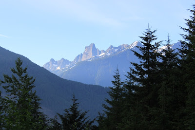
Parking lot view of Slesse

These red pods were infused right into the leaves everywhere...

When popped open, each pod contained a single worm...I wonder if this is a parasitic or symbiotic relationship of some sort..


Baby Munday


Slesse, Illusion Peaks, Canadian Border Peaks, Baker, etc

Snow melt

en route to Knight

final destination


The view between Knight and Baby Munday

Looking down at the scramble up Knight

Mountain goats! 11 of them!!! Hard to see but I couldn't resist a picture...

In the foreground ar the north and south peaks of Baby Munday. To the left is Stewart and the majestic peak in the background is the Still...my next hiking objective!!!

Looking down at Lady and Mount Cheam

Harrison Lake


Lunch Stop

Jones Lake


Summit shots from north peak of Baby Munday!


